HYDROGRAPHIC SURVEY
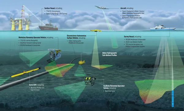
Hydrographic surveys plays a crucial role in various marine activities and decision- making processes. Hydrography is the science that measures and describes the physical features of bodies of water and the land areas adjacent to those bodies of water. Surveying with multibeam echo sounders is the primary method of obtaining hydrographic data. The multibeam echo sounder will equip with RTK GPS base survey system for DGPS corrections. Here are several ways in which RGIPL provides the hydrographic survey services to our customers with Multibeam, latest equipment’s and technology.
- Harbor surveys: Determine the best locations for harbor facilities and ensure safe navigation for vessels
- Passage surveys: Make inland waterways navigable
- Coastal surveys: Learn about the shoreline, sea-bottom sediments, and topography, and document flora and fauna.
- General hydrographic surveys: Measure water depths, coastlines, and geological features.
- Wreckage surveys: Locate the exact location of wreckage

